
Beschreibung
Straßenkarte Nova Scotia ISBN: 9781554862313 Maßstab: 1:600.000 Verlag: MapArt
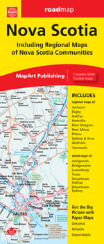
Indexed road map of Nova Scotia at 1:600,000 with coverage of much of New Brunswick plus Price Edward Island, plus more detailed mapping of Halifax and the Sydney area including street plans of their downtown districts, and Amherst, Digby, Glace Bay. New Glasgow - Pictou, North Sydney - Sidney Mines, Truro and Yarmouth; also ferry information and a distance chart.
The whole province is shown on one side at 1:600,000, with coverage of New Brunswick extending west to Fredericton and north to Miramichi, plus Prince Edward Island. Topography is indicated by colouring for national/provincial parks and other protected areas. Road network indicates paved or loose surface roads, and shows driving distances on main routes. Locations with scheduled air service are indicated and ferry connections show approximate transit times. Symbols show campsites, visitor information centre, ski areas and various places of interest. No geographical coordinates are provided; the index is on the reverse.
More detailed enlargements present local town at scales from 1:40,000 to 1:85,000, with street plans at 1:25,000 of downtown Halifax and Sydney. The map also includes a list of ferry operators with contact details, plus a distance table.