

Beschreibung
Xploreit Maps
Maßstab 1:100.000
Sprache: englisch
Wasserfest und Reißfest
mit schönen Straßen, Radwegen und Wanderwegen
Längen- und Breitengrade in 5' bzw. 10' - Intervallen
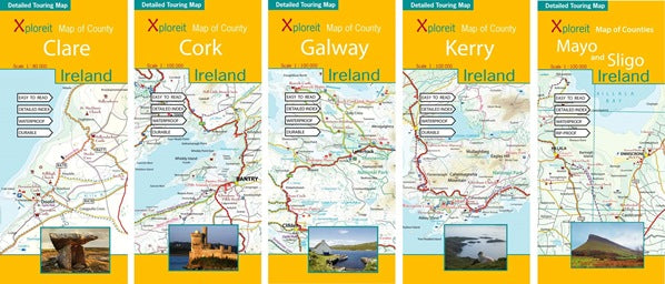
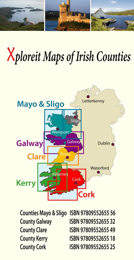
erhältlich für Mayo & Sligo, Galway, Clare, Kerry und Cork
Xploreit maps is an Irish publisher of detailed County maps of Ireland. The Xploreit County series covers a number of scenic Irish counties in a set of double-sided, waterproof, rip-proof maps. The maps highlight local and long distance walking trails, cycle routes and scenic drives. The road network includes local secondary roads and tracks with driving distances indicated on the main routes. Parking spots, railway lines and stations, ferry routes, harbors and local airports are included. Topography is shown using 30m contours with woodland areas, mountains, rivers and lakes clearly marked. A large set of symbols shows antiquities, golf courses, museums, heritage centers, tourist information points, beaches for surfing and swimming, campsites, caravan parks and many other local points of interest.
Maßstab 1:100.000
Sprache: englisch
Wasserfest und Reißfest
mit schönen Straßen, Radwegen und Wanderwegen
Längen- und Breitengrade in 5' bzw. 10' - Intervallen
erhältlich für Mayo & Sligo, Galway, Clare, Kerry und Cork
Xploreit maps is an Irish publisher of detailed County maps of Ireland. The Xploreit County series covers a number of scenic Irish counties in a set of double-sided, waterproof, rip-proof maps. The maps highlight local and long distance walking trails, cycle routes and scenic drives. The road network includes local secondary roads and tracks with driving distances indicated on the main routes. Parking spots, railway lines and stations, ferry routes, harbors and local airports are included. Topography is shown using 30m contours with woodland areas, mountains, rivers and lakes clearly marked. A large set of symbols shows antiquities, golf courses, museums, heritage centers, tourist information points, beaches for surfing and swimming, campsites, caravan parks and many other local points of interest.