
Beschreibung
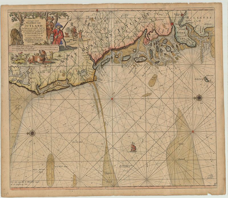
Paskaart vande Westkust van Jutland
Johannes van Keulen
Sehr schöne Seekarte mit der Westküste Schleswig-Holsteins und Dänemarks. Die Karte ist nach Osten ausgerichtet und reicht von Helgoland und Büsum über die Nordfriesischen Inseln bis Holmen an der Küste Jütlands. Die dekorative Titelkartusche oben links zeigt eine detailreiche Jagdszene. Die Nordsee ist mit zwei Kompassrosen und einem Segelschiff verziert.
Hochwertiger Fine Art-Print
Bildmaß: 51,5 x 59 cm
A easterly orientated chart of west coast of Schleswig-Holstein, Denmark and the North Sea. It includes Helgoland and Büsum on the North Frisian Islands on the coast of Jutland to Holmen. The decorative title cartouche shows a detailed hunting scene. The North Sea is decorated with two compass roses and a sailing ship. Johannes van Keulen (1654-1715) was the founder and leader of one of the most famous cartographic offices. His office acquired the stocks of Hendrik Doncker I (1626-1699) and Johannes Loots (1665-1726) in the years 1693 and 1707. The company published maps, guides, pilots and sea atlases. The first Zee-Atlas was published in 1680, followed in the years 1681-1684 in five volumes, the "Zee-Fakkel", both were republished several times and expanded. They are among the finest in Dutch cartography.
High Quality Fine Art-Print
Size: 51,5 x 59 cm